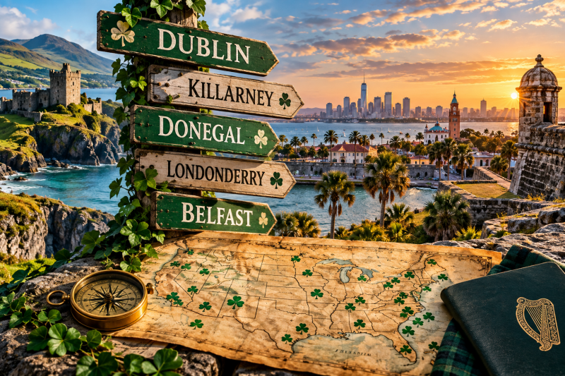
There is a funny thing that happens when you start looking closely at a map of the United States.
Ireland starts appearing everywhere.
Not metaphorically. Literally.
There is a Dublin in Georgia. Another in Ohio. Belfast sits on the coast of Maine. Derry and Londonderry share a corner of New Hampshire. Donegal survives in Pennsylvania. Montgomery, Alabama, carries the name of an Irish-born Revolutionary War general. Savannah has a park named for Robert Emmet. A South Carolina barrier island carries the surname of an Irishman who arrived there in the 1600s.
Here in Florida, we even have a place called Hibernia — the ancient Latin name for Ireland.
Once you notice it, you cannot stop noticing it.
And that sent me down a rabbit hole.
We talk quite a bit about Irish immigration to America, and understandably so. The Great Famine, Ellis Island, Boston, New York, the railroads, Catholic parishes, political machines and the rise of Irish Americans in American public life are all important chapters of the story.
But there is another Irish-American history sitting right in front of us.
It is written on the map.
Our towns, counties, islands, parks, military installations, roads and geographic landmarks preserve pieces of Irish history that most Americans drive past every day without ever realizing what the names mean.
Some were named directly for places in Ireland.
Others commemorate Irish-born Americans.
Some preserve surnames whose origins lead back across the Atlantic.
And some are much older than the mass Irish immigration most of us associate with Irish-American history.
That last part is particularly fascinating.
Because if we start here in Florida, the trail leads surprisingly far back.
Florida’s Irish History Is Older Than Most People Realize
When Americans think about early Florida, Ireland probably isn’t the first place that comes to mind.
Spain? Absolutely.
St. Augustine? Of course.
The Spanish Empire, the British period, Minorcans, Native peoples and eventually American territorial expansion dominate the story.
But Irish people were present in Spanish Florida centuries ago.
Researchers examining St. Augustine’s surviving parish records have identified more than 200 Irish names, according to work highlighted by the Diocese of St. Augustine. One particularly remarkable figure was Richard Arthur, an Irish-born soldier who became a Catholic priest and eventually served in St. Augustine. Historical research indicates that Arthur organized St. Patrick’s feast-day observances there between 1600 and 1602 — complete, apparently, with cannon fire. (Diocese of St. Augustine)
Think about that date for a second.
1600.
That is 20 years before the Mayflower.
It is more than two centuries before the great waves of nineteenth-century Irish immigration.
Irish history in what became the United States did not suddenly begin when famine ships entered northeastern ports.
Some of those roots run much deeper.
And Florida’s map still contains one particularly beautiful example.
Hibernia, Florida: Ireland on the St. Johns River
Drive through Clay County near Fleming Island and you will find Hibernia Avenue.
“Hibernia” is an old Latin name for Ireland.
That is not a coincidence.
Clay County’s historical archives explain that the Fleming family received a Spanish land grant in the area and used the name Hibernia for their property. The county still identifies Hibernia Avenue as deriving from that family and their Irish connection. Historical records for the community likewise identify Hibernia with what became the Fleming Island area. (Clay County Clerk of Court)
So tucked along the St. Johns River is a surviving linguistic monument to Ireland.
Not Dublin.
Not Cork.
Not Galway.
Ireland itself.
“Hibernia.”
There is something I love about that.
A person can drive down Hibernia Avenue today without thinking twice about it. It looks like another road name on another Florida road sign.
But pull on that historical thread and suddenly the sign connects modern Florida to Spanish land grants, Irish settlers and an ancient Roman name for an island thousands of miles away.
That is exactly what makes place-name history so fascinating.
A map can function almost like an archaeological site.
The layers are still there. You simply have to know how to read them.
And Then There Is Killarney
Central Florida provides another wonderfully direct example.
West of Orlando, near Lake Apopka, sits the community of Killarney.
The name traces directly to Killarney, Ireland.
The Florida community developed around the late nineteenth century, and a Killarney post office was established in 1887. The name survived even as Central Florida transformed dramatically around it. (Wikipedia)
Its Irish namesake, of course, is one of Ireland’s best-known places — the Killarney associated with County Kerry, its lakes, mountains and extraordinary landscape.
Somewhere along the way, somebody looked at a corner of Florida and decided that Killarney was the name it should carry.
More than a century later, it still does.
That is how cultural memory gets embedded into geography.
Sometimes deliberately.
Sometimes almost casually.
And sometimes permanently.
Georgia Has Its Own Dublin
Travel north from Florida into Georgia and the Irish map becomes even easier to see.
There is literally a Dublin, Georgia.
The city was incorporated in 1812 and became the seat of Laurens County. According to the New Georgia Encyclopedia, merchant and first postmaster Jonathan Sawyer selected the name to honor his wife’s ancestral home:
Dublin, Ireland. (Georgia Encyclopedia)
That is a wonderfully simple origin story.
No complicated political symbolism.
No military campaign.
No royal decree.
Someone carried a family connection to Dublin across the Atlantic, and that memory eventually became the name of an American city.
More than two centuries later, thousands of people write “Dublin, Georgia” on envelopes, business cards, driver’s licenses and addresses.
The ancestral memory became ordinary American geography.
That pattern repeats again and again across the country.
But Georgia’s Irish geography does not end there.
Savannah Put Robert Emmet on the Map
Savannah’s relationship with Ireland is much deeper than its enormous St. Patrick’s Day celebration.
Irish immigrants were present in Georgia from the colony’s earliest years, and the population expanded substantially during the nineteenth century. Georgia Southern University’s Center for Irish Research and Teaching notes that by 1860 roughly one in four of Savannah’s non-enslaved residents was Irish-born. (Georgia Southern University -)
Even more interesting is how geographically specific that migration could be.
Research on the Savannah-Wexford connection found that among direct Irish arrivals to Savannah during the peak years from 1848 through 1852 for whom origins were identified, 56.1 percent listed Wexford as their point of origin. (Irish Research + Teaching)
That means Savannah did not merely become “Irish.”
It developed an unusually strong connection to one particular part of Ireland.
County Wexford.
The Atlantic did not erase local identity. In some cases, communities essentially reconstructed pieces of it on the American side.
Then look at Savannah’s map.
Near the waterfront is Emmet Park.
The park bears the name of Robert Emmet, the Irish republican whose failed 1803 uprising and subsequent execution made him one of the most enduring figures in Irish nationalist history. Savannah sources note that the space once called the Irish Green was ultimately named for Emmet, and today a Celtic cross stands there among its monuments. (Visit Savannah)
A Georgia city therefore has Robert Emmet permanently embedded into its public geography.
You can walk through his name.
Sullivan’s Island: An Irish Name at the Entrance to Charleston Harbor
Continue north along the coast and you reach one of my favorite examples.
Sullivan’s Island, South Carolina.
The name sounds so ordinary that most people probably never ask where “Sullivan” came from.
They should.
The island takes its name from Florence O’Sullivan, an early Irish settler who arrived in the Carolina colony in the seventeenth century.
The Town of Sullivan’s Island’s own historical material identifies O’Sullivan as an Irish settler and records that he was given responsibility for guarding Charleston Harbor. The island became associated with him as “O’Sullivan’s Island,” eventually shortened to Sullivan’s Island. (Sullivan’s Island)
Consider how much American history eventually occurred on a geographic feature carrying his name.
The Battle of Sullivan’s Island in 1776 became an important early American victory during the Revolution.
Fort Moultrie stood there.
The island became deeply connected to Charleston’s military history.
It also carries a much darker history: Sullivan’s Island served as a major quarantine and processing point through which enslaved Africans entered the Carolina colony. (South Carolina Encyclopedia)
All of those histories accumulated around a place whose modern name still reaches back to an Irishman who arrived in Carolina in 1669.
Again, the Irish layer of the American map is sometimes much older than we assume.
Burke County Leads Back to Galway — and Another Burke Leads to Dublin
The Southeast offers another interesting lesson: identical Irish surnames on American maps do not necessarily lead to the same person.
Take Burke.
North Carolina’s Burke County was created in 1777 and named for Thomas Burke, an American revolutionary leader who later became governor of North Carolina.
Thomas Burke was born in County Galway, Ireland, in 1747.
He emigrated to Virginia, practiced medicine and law, entered revolutionary politics, served in the Continental Congress and eventually became governor. During the Revolutionary War he was captured by Loyalist forces and imprisoned. (America 250)
So Burke County, North Carolina, provides an unusually direct chain:
Burke County → Thomas Burke → County Galway, Ireland.
But cross into Georgia and Burke County there tells a different Irish story.
Georgia’s Burke County was named for Edmund Burke, the political philosopher and British parliamentarian who supported conciliation with the American colonies. (Georgia Encyclopedia)
Edmund Burke was born in Dublin.
Same surname.
Different county.
Different man.
Different connection to Ireland.
The map is not merely covered with Irish names.
It contains overlapping Irish stories.
Montgomery, Alabama, Leads Back to Ireland Too
Now head west.
Montgomery, Alabama, is one of the most historically consequential cities in the United States.
The Confederate government operated there briefly.
Decades later, Montgomery became central to the modern Civil Rights Movement.
But where did “Montgomery” come from?
Interestingly, Montgomery County and the City of Montgomery have different namesakes.
The county honors Major Lemuel P. Montgomery, who died at the Battle of Horseshoe Bend.
The city, however, was named for Revolutionary War general Richard Montgomery. (Montgomery County, AL)
And Richard Montgomery was Irish.
He was born in 1738 near Raphoe in County Donegal. He served initially in the British Army before settling in America and joining the revolutionary cause. He was killed during the failed American assault on Quebec City on December 31, 1775. (Montgomery County Government)
That gives us another remarkable chain across geography:
Montgomery, Alabama → Richard Montgomery → Raphoe, County Donegal.
Every time someone says “Montgomery,” a little piece of Donegal echoes through American geography whether anyone realizes it or not.
Fort McHenry Leads Back to County Antrim
Military geography gives us another category of Irish names hidden in plain sight.
Fort McHenry in Baltimore is practically inseparable from American national identity.
The British bombardment of the fort during the War of 1812 inspired Francis Scott Key to write the words that became “The Star-Spangled Banner.”
But McHenry was a person.
James McHenry.
And James McHenry was born in Ireland.
The National Park Service records that McHenry was born in Ballymena, County Antrim, in 1753 and emigrated to America at 18. He became a physician, served the revolutionary cause and eventually became secretary of war. Fort Whetstone at Baltimore was expanded and renamed Fort McHenry in his honor. (National Park Service)
So one of the most iconic military sites in the United States carries a surname connected directly to County Antrim.
That connection is rarely the first thing Americans learn about Fort McHenry.
But it is sitting right there in the name.
Pennsylvania Has a Piece of Donegal
Then there are American communities named not for people but directly for Irish geography.
Pennsylvania provides a fantastic example.
Donegal Township was established in what became Lancaster County during the early eighteenth century. Its descendants include East Donegal and West Donegal Townships.
West Donegal Township’s government states plainly that the community was named for County Donegal, Ireland, and that the area’s early settlers were predominantly Scots-Irish. The original Donegal Township was organized in 1722. (West Donegal Township)
That makes “Donegal” one of the older transplanted Irish geographic names in British North America.
And it reflects a broader historical movement.
The Irish government notes that roughly 250,000 Scots-Irish people migrated from Ireland to the American colonies between 1717 and 1775. Many initially entered through Pennsylvania before moving south and west through the interior. (Ireland)
They carried names with them.
Antrim.
Tyrone.
Derry.
Donegal.
The American frontier became dotted with memories of Ulster.
New Hampshire May Be the Clearest Irish Map in America
If you really want to see this phenomenon concentrated in one place, look at New Hampshire.
Londonderry.
Derry.
Antrim.
Those names are not decorative modern attempts to create an Irish identity.
They go back centuries.
The settlers who established Londonderry, New Hampshire, were Ulster Scots who had lived in Ireland before crossing the Atlantic. Historical accounts trace many of them to the Bann Valley area of Ulster. They established their settlement at Nutfield before obtaining a township charter in 1722 and adopting the name Londonderry after the place they had left behind. (Londonderry History)
Later, Derry separated from Londonderry.
The Town of Derry’s own history explains that the new community adopted “Derry,” the older Irish name associated with Londonderry. (Derry NH)
Nearby Antrim was incorporated in 1777 and named for County Antrim, Ireland, according to New Hampshire’s official state historical material. (New Hampshire Secretary of State)
Put those names together on a map:
Derry.
Londonderry.
Antrim.
You are looking at New Hampshire.
But linguistically, you are also looking across the Atlantic.
Belfast, Maine: An Irish City Recreated on the American Coast
Keep traveling through New England and eventually you reach Belfast, Maine.
The city’s official history says Belfast was settled beginning in 1770 by Scots-Irish families who came from Londonderry, New Hampshire.
And yes, the name refers to Belfast in Ireland.
The traditional story is wonderfully human.
According to local history, settlers disagreed over whether their new community should be called Londonderry or Belfast.
So they settled it with a coin toss.
Belfast won. (Belfast Museum)
Whether every detail of a centuries-old coin-toss story can be proven is another question, but the underlying Irish naming connection is well established.
And look at what happened.
Migration went from Ireland to New Hampshire.
Then descendants and settlers moved from New Hampshire to Maine.
And the names traveled with them.
Ireland → Londonderry, New Hampshire → Belfast, Maine.
The map records migration almost like footprints.
Dublin Crossed America Too
Dublin may be the most obvious Irish place name transplanted into the United States.
We already have Dublin, Georgia.
Then there is Dublin, Ohio.
The Ohio community began under another name, but local tradition holds that surveyor John Shields was given the privilege of naming the developing settlement around 1810.
Shields chose Dublin.
According to the Dublin Historical Society, he selected the name in memory of his birthplace in Ireland. (Dublin Historical Society)
The same basic phenomenon appears again.
Someone leaves Ireland.
Someone remembers home.
Someone names a place.
Two centuries later, tens of thousands of Americans inherit the name without necessarily inheriting the memory behind it.
That is the strange permanence of naming.
Buildings disappear.
Families move.
Industries collapse.
Governments change.
Names can survive all of them.
Sometimes an Irish Surname Travels Farther Than the Irish Place Name
The western United States contains a slightly different layer of this history.
Consider Sheridan, Wyoming.
The city was founded in the 1880s and named for Union general Philip Sheridan.
Sheridan himself was American-born, but his parents were Irish immigrants from County Cavan. Local historical accounts specifically connect the family to Killinkere in Cavan. (Sheridan Wyoming)
So the geographic chain becomes:
Sheridan, Wyoming → Philip Sheridan → Sheridan family → County Cavan.
That is a different kind of Irish geography.
The American place is not named after an Irish town.
It is named after an American whose surname and family history crossed the Atlantic.
Thousands of similar examples exist at smaller scales — streets, neighborhoods, schools, creeks, hills, cemeteries and municipal landmarks.
The United States Geological Survey’s Geographic Names Information System contains records for more than one million domestic geographic features, including populated places, lakes, streams, summits, valleys and ridges. (USGS)
Start searching those names through an Irish lens and the scale of this history becomes enormous.
The Names Tell Us Something Immigration Statistics Cannot
This is what fascinates me most.
Immigration statistics tell us how many people came.
Census records tell us where they lived.
Passenger lists tell us where they departed and arrived.
Church records tell us whom they married, baptized and buried.
But place names tell us something slightly different.
They tell us what people remembered.
When settlers named an American community Donegal, they were preserving a connection to Donegal.
When someone chose Dublin, they were carrying Dublin with them.
When an American city honored Richard Montgomery, it unintentionally preserved the memory of an Irish-born man from County Donegal in the geography of Alabama.
When Baltimore named a fort for James McHenry, Ballymena acquired a quiet connection to the place that would inspire America’s national anthem.
When Savannah named a public space for Robert Emmet, the memory of Ireland’s revolutionary history entered Georgia’s civic landscape.
And when Hibernia appeared beside Florida’s St. Johns River, an ancient name for Ireland found a second home beneath subtropical palms.
These names are tiny historical time capsules.
But We Should Read the Map Carefully
There is also an important warning here.
Not every Sullivan, Murphy, Kelly, Burke, Carroll or Kennedy on an American map automatically represents Irish immigration.
Names can have multiple origins.
Places are renamed.
Folklore sometimes replaces documentation.
Even seemingly obvious Irish names may have complicated histories.
That is why the fun part is not simply finding an Irish-looking word.
It is tracing it.
Who selected the name?
When?
Why?
Was it named directly for Ireland?
For an Irish immigrant?
For an Irish American several generations removed?
For a military officer?
A politician?
A landowner?
A saint?
A revolutionary?
A family?
Or was the apparent Irish connection simply coincidence?
Good local history begins with asking those questions rather than assuming the answer.
And fortunately, we have more tools for doing that than ever.
County archives, historical societies, state libraries, university collections, old maps, land grants, military records and the USGS Geographic Names Information System make it possible to follow these trails surprisingly far.
Sometimes all it takes is wondering why a road has the name it has.
America Did Not Simply Absorb the Irish — the Irish Helped Name America
That may be the larger lesson hidden inside all of this.
We usually tell Irish-American history through people.
And we should.
But people leave fingerprints on places.
The Irish presence in America did not remain confined to immigrant neighborhoods in Boston, New York, Philadelphia or Chicago.
It moved through colonial Florida.
Across the Carolinas.
Into Georgia.
Along the Appalachian frontier.
Through Pennsylvania.
Across New England.
Into the Midwest.
And eventually all the way west.
The evidence is still sitting on highway signs.
Hibernia.
Killarney.
Dublin.
Emmet.
Sullivan.
Burke.
Montgomery.
McHenry.
Donegal.
Derry.
Londonderry.
Antrim.
Belfast.
Sheridan.
Each name opens a door.
Behind one is County Galway.
Behind another is Dublin.
Another leads to Raphoe in Donegal.
Another to Ballymena in Antrim.
Another to County Cavan.
Another to Belfast.
Another to Wexford.
And another simply leads back to Ireland itself.
Hibernia.
There is something profoundly human about that.
People leave home, sometimes voluntarily and sometimes because circumstances give them very little choice. They cross oceans. They build new lives. Their children become Americans. Their grandchildren may know Ireland only through stories.
Eventually even those stories can fade.
But somebody puts the old name on a town.
Or a road.
Or a county.
Or an island.
And suddenly memory lasts longer than the person who carried it.
Centuries pass.
Cars replace horses.
Interstates replace wagon roads.
Cities rise around settlements that once consisted of a handful of houses.
Yet the name remains.
That is why I think the next time you see an Irish-looking name on an American map, don’t just drive past it.
Look it up.
Follow it backward.
Because you may discover that the road underneath your tires leads much farther than you thought.
Sometimes all the way across the Atlantic.
And sometimes, all the way home.
Add comment
Comments